
1761 – A General Map of North America


“A General Map of North America”, by British cartographer John Rocque, contains one of the first modern historical references to a body of water where the current Salton Sea is located. The map, sometimes referred to as the ‘Rocque Map of North America’, indicates the presence of a body of water where the Salton Sea would one day form. It also depicts a river flowing into the lake from mountains to the north. It is inaccurate because the terrain between the lake and the Colorado River to the east makes it physically impossible for water to flow into or out of the region shown on the map. The map correctly depicts the junction of the Colorado River and Gila River.
Most of the Rocque Map is based on other maps and verbal descriptions from explorers rather than first hand observation by Mr. Rocque. There is very little written evidence beyond the map that supports the existence of a body of water in the region that predates the Salton Sea. But later exploration of the area would prove that a lake had existed there in the past.
At the time publication the map was the most accurate and complete representation of the North American Continent which also included a body of water where the Salton Sea would one day exist.
A General Map of North America by John Rocque
Original Full Title; A general map of North America; in which is express’d the several new roads, forts, engagements, &c. taken from actual surveys and observations made in the army employ’d there, from the year 1754, to 1761
Note: When examining the map, notice the existence of a body of water located in southern California, USA that predated the Salton Sea by more than a century.
High Resolution Image
Super High Resolution Image
Super High Resolution Image with Super Zoom
Full Size RAW
1783-1898 – United States of America Expansion


Expansion of the United States continued with the purchase of the Louisiana Territory from France in 1803. Over the next half century, exploration, mapping, and development of newly acquired territories was commissioned by the United States government resulting in hundreds of different expeditions, the most famous made by Lewis and Clark. The last large acquisition in the expansion of the continental United States was from the Mexican government shortly after the conclusion of the Mexican – American war in 1848. The new territory included California among other future states.
The United States intended to expand further south by purchasing land from Mexico that included the California Baja Peninsula in what would be known as the Gadsden Purchase of 1853, but the Mexican president Santa Anna balked at the offer and instead agreed to the purchase of less territory that did not include the peninsula. The territory gained from the purchase was mainly intended to provide an easier route for a southern transcontinental railroad. It included land south of New Mexico and Arizona, but did not include land west of the Colorado River that would one day be used to provide irrigation water to southern California.
During this period, the California Gold Rush reached its peak, prompting population increases and proposals to build transcontinental railroads.
Map Depicting Territorial Expansion of the United States of America between 1783 and 1898
High Resolution Image
Super High Resolution Image
Sources & Additional Information
Nov 1853 – William Phipps Blake
In the fall of 1853 an explorer named William Phipps Blake traveled to an area in southern California, USA known then as the Colorado Desert, which would one day become the home of Salton Sea.
Mr. Blake was tasked by the United States Congress to explore potential routes for a transcontinental railroad along the southern border of the country. After compiling the information collected, he submitted a report of his explorations to congress in 1858. The report included the first modern scientific observations and measurements of the region, including the fact that portions of it were below sea level.
The report contained a wealth of information, including an opinion about reclaiming the desert land and turning it into rich farmland with water from the Colorado River.
William P. Blake and Companions Entering the Colorado Desert on November 15, 1853
Perspective: The image is drawn looking south, southwest into the Coachella Valley and Salton Trough.
Sources & Additional Information1853 – Lake Cahuilla
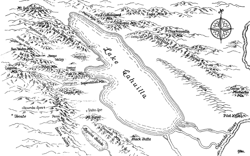
Lake Cahuilla is a body of fresh water that existed in the same region the Salton Sea occupies today in southern California, USA . The lake was much larger than the Salton Sea and occupied the entire Salton Trough including most of the area known today as the Imperial Valley. Over several millennia the lake formed and disappeared many times due to evaporation and changing path of its main water source, the Colorado River.
An explorer named William Phipps Blake visited the area in the 1850s as part of an expedition to explore possible routes for the Transcontinental Railroad for the United States of America. He was the first person to scientifically assess and describe the region in great detail. At the time of his exploration the lake was dry, but as part of his study of the area Mr. Blake found evidence that a great lake had once existed in what was then a desert. He named it Lake Cahuilla, after the local Native American people that inhabited the region. In his survey, he postulated that waters from the Gulf of California / Sea of Cortez had at some time in the past extended into the area. This assessment was incorrect as waters from the Gulf / Sea have never encroached into the Salton Trough. The mistake was made because tectonic plate movement and large scale subsidence were not yet understood.
Illustration of Lake Cahuilla and the Surrounding Region
Note; In present day, there is a modern man made reservoir to the west of Vista Santa Rosa, CA, USA named Lake Cahuilla. The reservoir occupies a very small section of the northern portion of the basin where the ancient Lake Cahuilla existed.
Sources & Additional Information1857 – 19th Century Irrigation Systems
In 1857 Oliver Meredith Wozencraft made the first widely publicized proposal to take water from the Colorado River and divert it to the area where the Imperial Valley and Salton Sea exist today for irrigation. At the time, the entire region was a dry desert landscape known as the Colorado Desert. It would be almost another half century before the Salton Sea was created and the region to the south became the rich verdant farmland it is today.
Several years prior, William P. Blake conducted a survey of the region and included similar ideas about irrigation in a report submitted to the United States Congress. Mr. Wozencraft’s had a much grander concept in mind than Mr. Blake’s. He wanted to fill the entire Salton Trough with water diverted from the Colorado River, recreating the ancient Lake Cahuilla, and then draw irrigation water from the lake. If his plans had come to fruition, the Imperial Valley would be much smaller than it is today.
Wozencraft continued to promote the idea for many years, but nothing was developed or came of his proposal until well after his death.
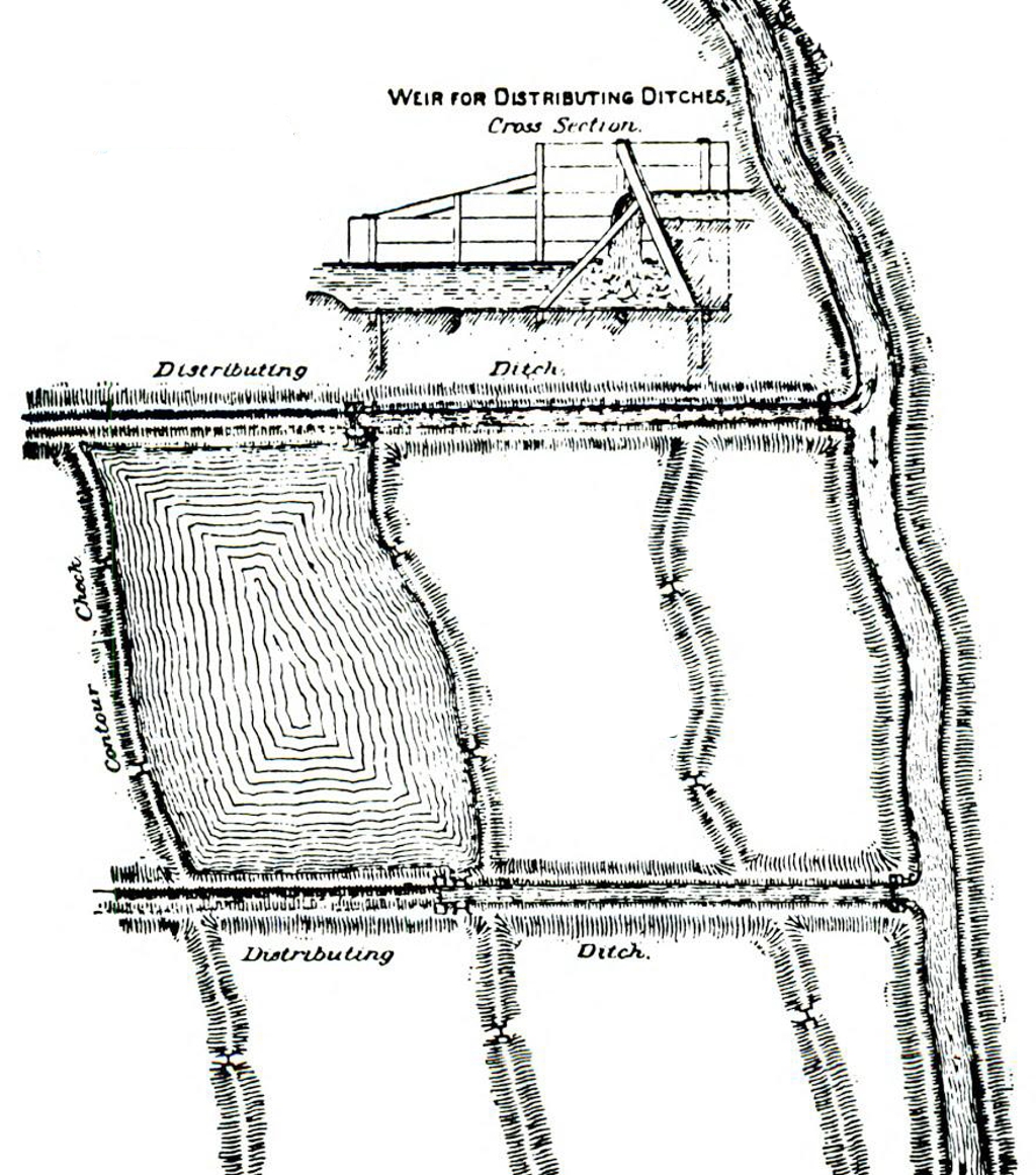
Typical Irrigation System used in the 19th Century
Sources & Additional Information1867 – Exploration and Reclamation
After the American Civil War, the focus of the United States of America turned to reconstruction and exploration of the territory in the west for developing natural resources. Among the many development projects considered were the reclamation of desert lands in the western United States of America, including the Salton Trough, where the Salton Sea lies today.
Several small scale reclamation efforts were made to ‘reclaim’ and irrigate the desert lands of the southwest USA. This included the Salton Trough where the Imperial Valley and Salton Sea are located. These endeavors were made before the Newlands Reclamation Act of 1902. Reclamation was possible in the Salton Trough because of readily available water supply from the Colorado River to the south.
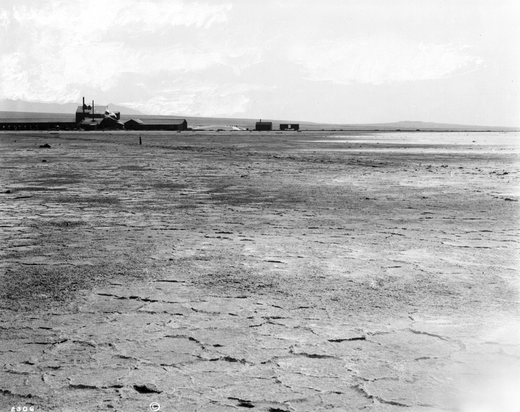
The Imperial Valley, CA, USA in 1901 before Water was Introduced for Irrigation
Jan 1873
For many years Joseph Widney had proposed refilling the Salton Sink with water from the Colorado River and recreating the ancient inland lake.
It garnered support from the California Congress and eventually became known as the Widney Sea, but never came to fruition.
Early Map of the ‘Widney Sea’
The map includes locations of future cities as reference points.
Sources & Additional Information1877
The Southern Pacific Railroad completed a railway from Los Angles, through the Salton Sink and Colorado Desert, to Yuma, AZ.
This was the first major step in developing the region that would soon become the Imperial Valley.
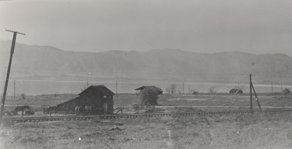
Southern Pacific Railroad Train Depot in the Salton Sink
Sources & Additional Information1884
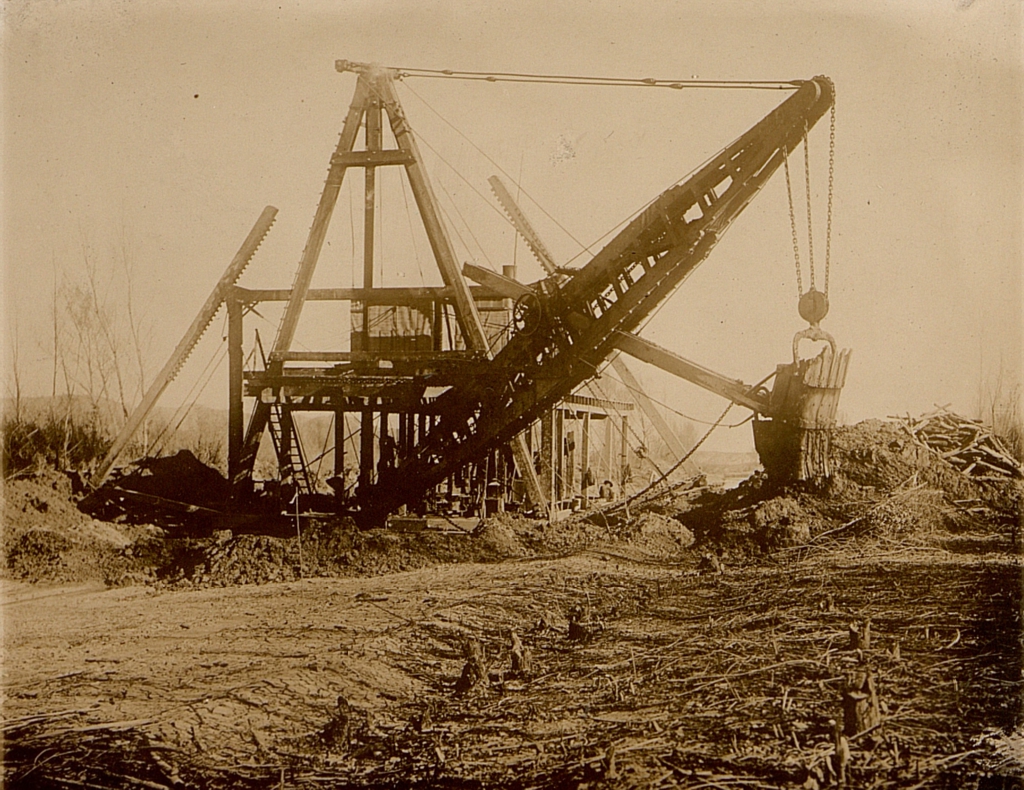
In the late 19th century salt was a much prized commodity, far more valuable than it is today. The New Liverpool Salt Company was the first large industry created in the Salton Sink. Unlike salt mined in other regions, the salt in the Salton Sink was extremely pure, making it a very profitable venture for many years.
The railway, finished by the Southern Pacific Railroad several years prior, was a key part of making this endeavor possible, as well as many other business ventures in the future.
The New Liverpool Salt Company in the Salton Sink
Notice the railroad tracks and boxcar to the right of the building and the piles of salt with men on them between the main building and the boxcar.
High Resolution Image
Super High Resolution Image
Super High Resolution Image with Super Zoom
1889
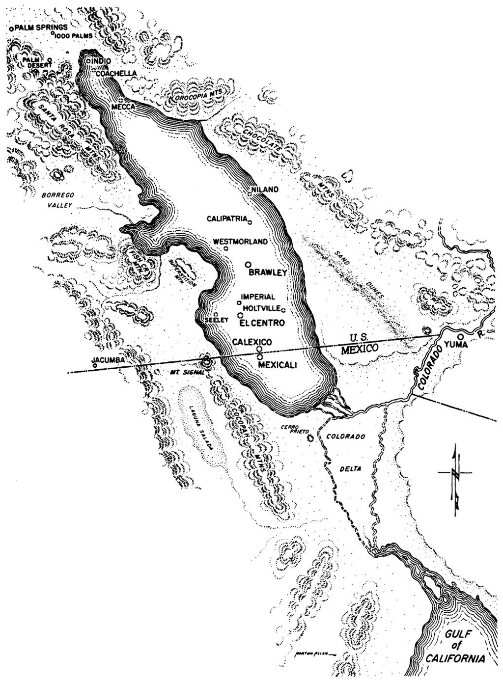
San Diego County originally included the Salton Sink and the Imperial Valley among other locations.
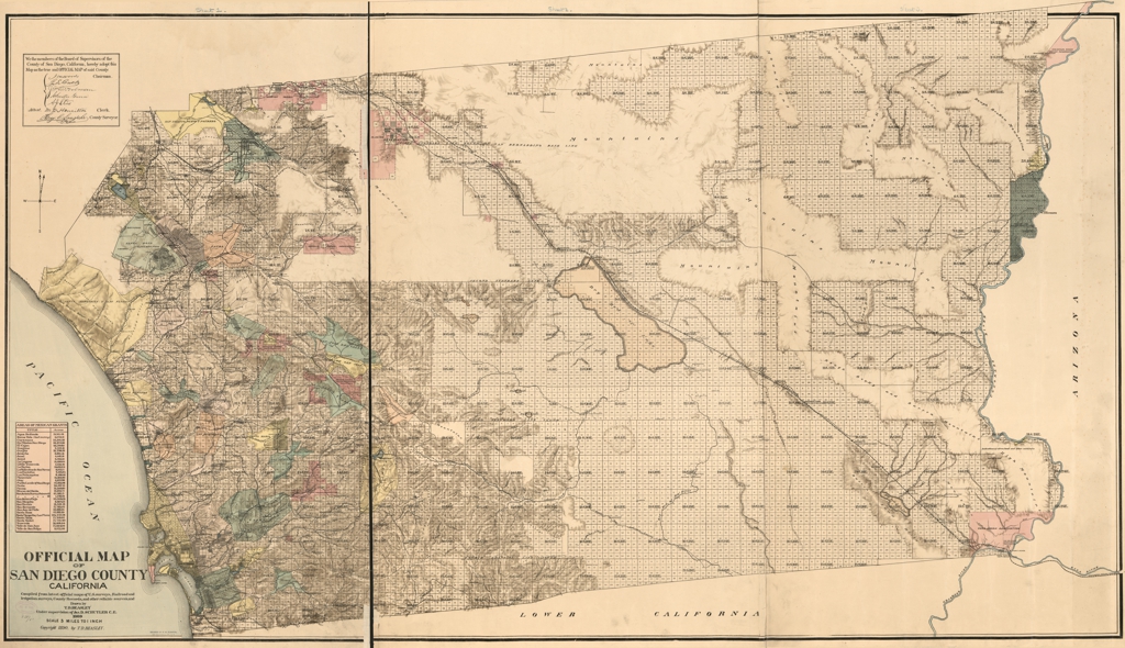
Official Map of San Diego County California, USA
Drawn by Thomas D. Beasley under the supervision of James Dix Schuyler – 1889
High Resolution Image
Super High Resolution Image
Super High Resolution Image with Super Zoom
Jun 1891
Unusually high water volume of the Colorado River caused it to overflow into the Salton Sink and resurrect a small portion of Cahuillia Lake once again. The lake only grew to a shallow depth and occupied a much smaller area compared to past incarnations.
This was the last natural formation of the lake prior to the creation of the body of water now known as the Salton Sea.
Early Map of the Imperial Valley showing areas prone to flooding. The Alamo River (also known as the East River and Salton River) is not indicated on this map.
Sources & Additional Information
Jan 1892
The Colorado River Irrigation Company was formed to create a series of canals and bring water from the Colorado River into what would become the Imperial Valley with Charles Rockwood as the chief engineer. The company did not escape the financial crisis of 1893 and ultimately failed in 1894.
All of the records, maps, surveys, and data related to the irrigation project were turned over to Mr. Rockwood in compensation for his unpaid salary.
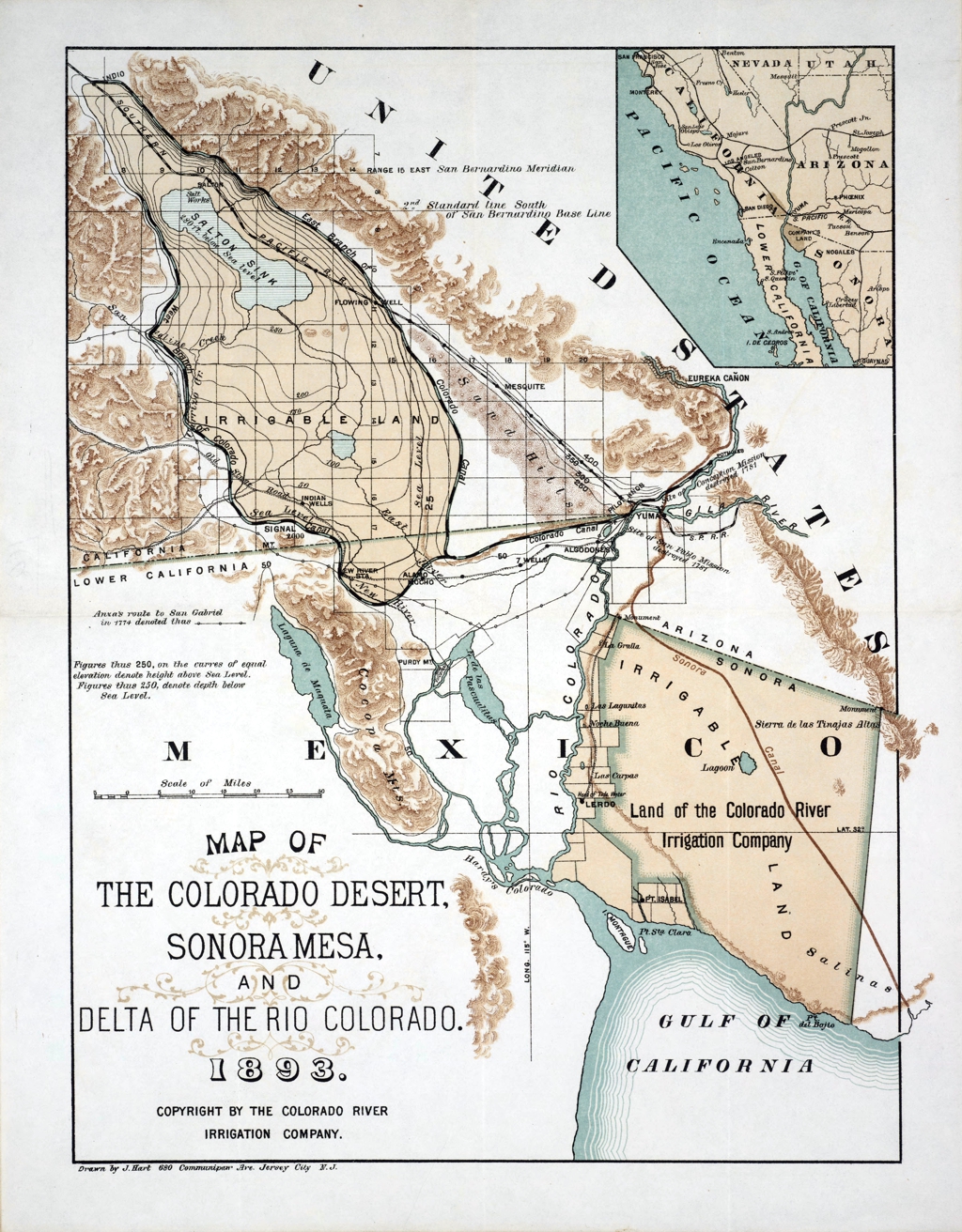
Map of Irrigable Lands with Planned Routes for Canals
Note; This map was only a proposal for the reclamation, development, and irrigation of the ‘Colorado Desert’ with no consideration for a permanent body of water. The area labeled as the Salton Sink is drawn as a body of water because it was known that the region would occasionally flood to a very shallow depth.
High Resolution Image
Super High Resolution Image
Super High Resolution Image with Super Zoom
May 1893
The San Francisco Chronicle reports on the efforts of the Colorado River Irrigation Company and Dr. Rockwood to acquire property in the Colorado Desert and the plan to irrigate it with water from the Colorado River.

Newspaper Clipping from the San Francisco Chronicle May 6, 1893
Sources & Additional InformationApr 1896
The California Development Company was created by Charles R. Rockwood as a successor to the Colorado River Irrigation Company. It had a similar purpose which was to bring irrigation water from the Colorado River and deliver it to the soon to be named Imperial Valley.
Having already worked on the project for several years with the Colorado River Irrigation Company, Mr. Rockwood had tremendous faith that the project would be a profitable success.
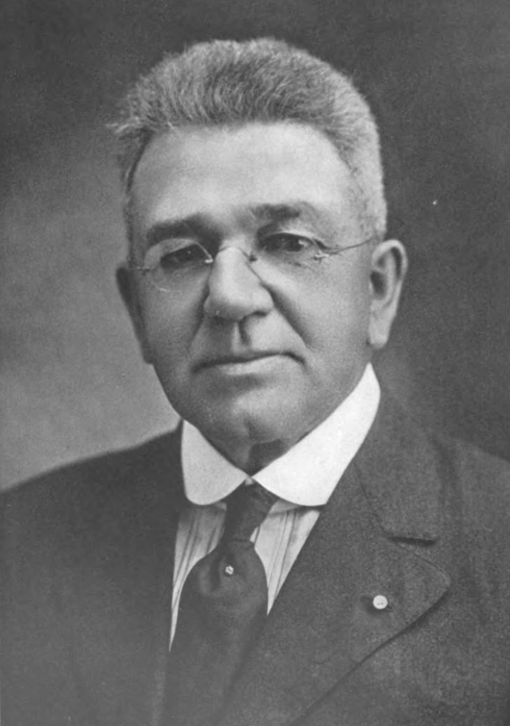
Charles Robinson Rockwood, 1860-1922
Sources & Additional Information1896 – 1900
Because of difficulties with the planned route of the main canal, doubts in the ultimate success of irrigating the ‘Colorado Desert’, and the distraction of other national events, such as the sinking of the USS Maine, significant work on the project was not advanced for almost half a decade.
During this time, Charles Rockwood desperately tried to find investors for his company and funding for the project, but was unsuccessful.
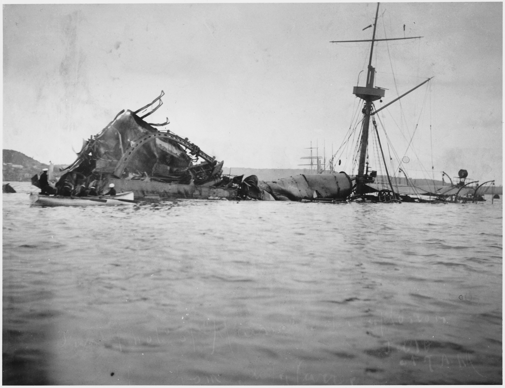
USS Maine Sunk in Havana Harbor on Feb 18th, 1898
Sources & Additional InformationMar 1900
George Chaffey joined the California Development Company (CDC) as an investor, president, and chief engineer. He created the Imperial Land Company with several other people to promote settlement of the region, thus providing customers for The CDC and the water they would soon deliver from the Colorado River. As part of the promotional effort, it was decided to change the name of the Colorado Desert and Salton Trough to the Imperial Valley as it was felt that terms like desert and sink might deter people from moving to the region.
Without Mr. Chaffey’s investment, the CDC would never have survived and the canals would never have been built, however he was also solely responsible for planting the seeds of disaster. He only remained with the company a couple of years before divesting his shares, leaving Charles Rockwood in charge of the business.
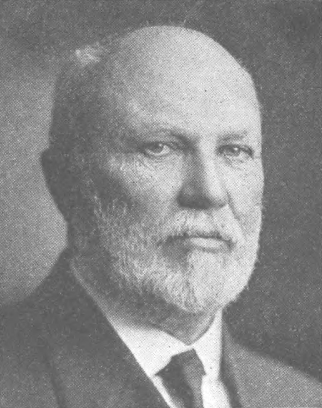
George Chaffey, 1848 – 1932
Sources & Additional InformationApr 1900
The original plans from the Colorado Irrigation Company had called for the canal to be routed west around the southern edge of the Algodones Dunes. But that path was considered too costly and time consuming by Mr. Chaffey, so the route of the Alamo Canal, later known as the Imperial Canal, was modified.
The beginning of the canal was moved further south near Pilot Knob, CA, USA (red circle). But instead of going west towards the Imperial Valley, its path turned south into Mexico running roughly parallel with the Colorado River for about 4 miles (green line). From there it connected (purple circle) with with naturally existing overflow channels known as the Alamo Arroyos (yellow lines) with one that was dredged and enlarged into a canal sized channel. The path of the dredged canal meandered westward across Mexico where the other arroyos combined to form the Alamo River (blue line) which continued westward until turning north and crossing the border back into California, USA at Sharp’s Heading (orange circle) and then into the Imperial Valley.
The changes from the original planned route, among many other modifications made by Mr. Chaffey, would later prove to be significant contributing factors to the flooding of the Salton Sink.
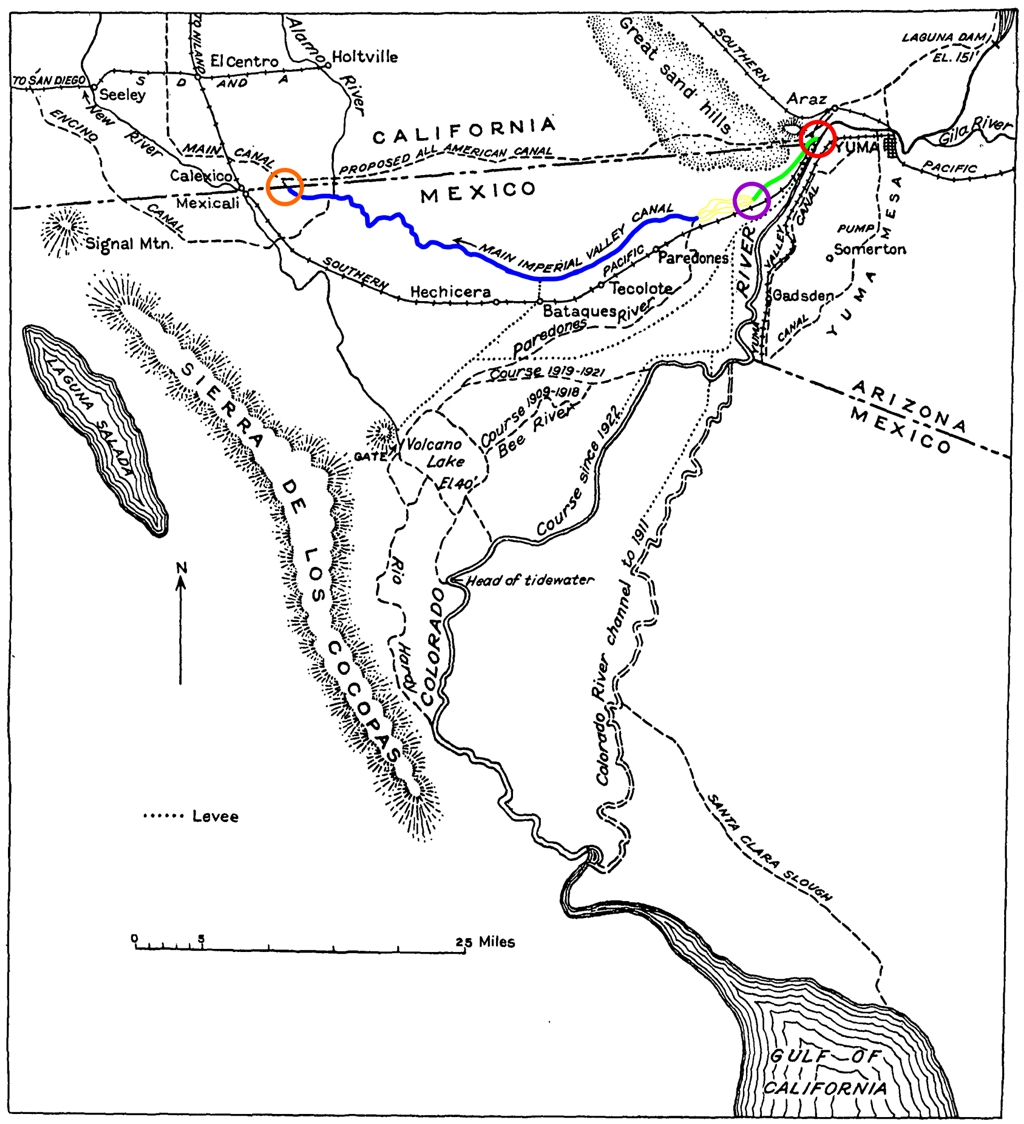
Planned Route for the Imperial – Alamo Canal
May 1900
Because the vast majority of the Imperial / Alamo canal’s planned route was in Mexico, permission had to be obtained from the Mexican government along with the purchase of vast amounts of property in Mexico. The government eventually granted permission on the condition that the ownership and operations of the canals in Mexican territory be controlled by a Mexican company. The Colorado Development Company agreed and formed La Sociedad de Riego y Terrenos de la Baja California, Sociedad Anonima (The Irrigation and Land Group of Baja California, Anonymous Group).
Modern examination of these business transactions has discovered some were of a questionable nature and it is suggested that the Mexican Government and citizens were taken advantage of by the US companies.
Mexican Flag Overlay of Mexico
Sources & Additional InformationTimeout: Question, Answer, and an Explanation
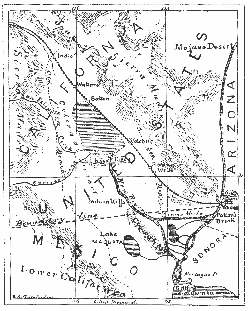
"Why was the Imperial / Alamo Canal (green line) dug 4 mile in the opposite direction of where the water needed to be delivered, parallel to the Colorado River?
Answer: Geography, Money, Politics, and the Law
Geography; The southwestern portion of California, USA includes a small mountain range referred to as the Chocolate Mountains. This range comes to an end in southern California, USA close to the US / Mexican border at Pilot Knob, California, USA, just north of Hanlon Heading close to where the Chaffey Headgate was built and the Hanlon Headgate still exists today. In the south and west, the mountain range tapers off into a region known as the Algodones Dunes which extends into Mexico for several miles. The land to the south of the dunes slopes downward from east to west and on the west side the downward grade continues north into the Imperial Valley and Salton Sea. The easiest way to deliver water from the Colorado River to the Imperial Valley is around the southern edge of the Algodones Dunes in Mexico.
Money; To dig a canal within the boundaries of the United States where the All American Canal exists today (thin dark green line labeled All American Canal) would have cost millions of dollar even in 1900 and the California Development Company had neither the resources nor time to construct a canal on that scale. The predecessor to the California Development Company (The Colorado River Irrigation Company) had planned the route of the canal (blue line) to skirt around the southern edge of the dunes in Mexico and then north into the United States. The canal engineer, George Chaffey, went one step further and decided to route the canal (light blue line) through the existing Alamo Arroyos as an additional cost savings measure. The route was longer, but it was much cheaper and faster to dredge out the arroyos into larger channels than to dig a new canal that followed the edge of the dunes.
Politics; From an engineering standpoint placing the start of the canal about 4 miles to the south of the US / Mexican border would have made much better sense than the actual beginning of the canal at Pilot Knob. The canal was constructed in this manner to overcome a technical legal issue as to the ownership of the water. Because the water from the Colorado River entered the canal in US territory, it meant that the water delivered to the Imperial Valley was 'American' water', not 'Mexican water'.
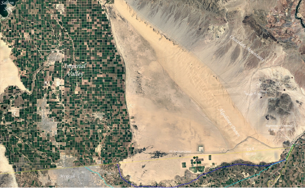
Satellite Image of Algodones Dunes and Imperial Valley in Southern California, USA
High Resolution Image
Super High Resolution Image
Super High Resolution Image with Super Zoom
Aug 1900
Construction of the Chaffey Headgate for the canal’s water intake from the Colorado River was started just inside the US / Mexican border, south of Pilot Knob, USA. Originally, the headgate was to be located several miles upstream at Potholes, CA, USA, but George Chaffey elected to relocate it as a time and cost savings measure. The wooden structure was supposed to be temporary with a permanent concrete headgate constructed further upstream where the Hanlon Headgate was eventually built, but there were no firm plans or a timeline to complete the task.
Mr. Chaffey also constructed the bottom of the headgate too high which prevented proper water flow into the canal during the summers when the river level was lower.
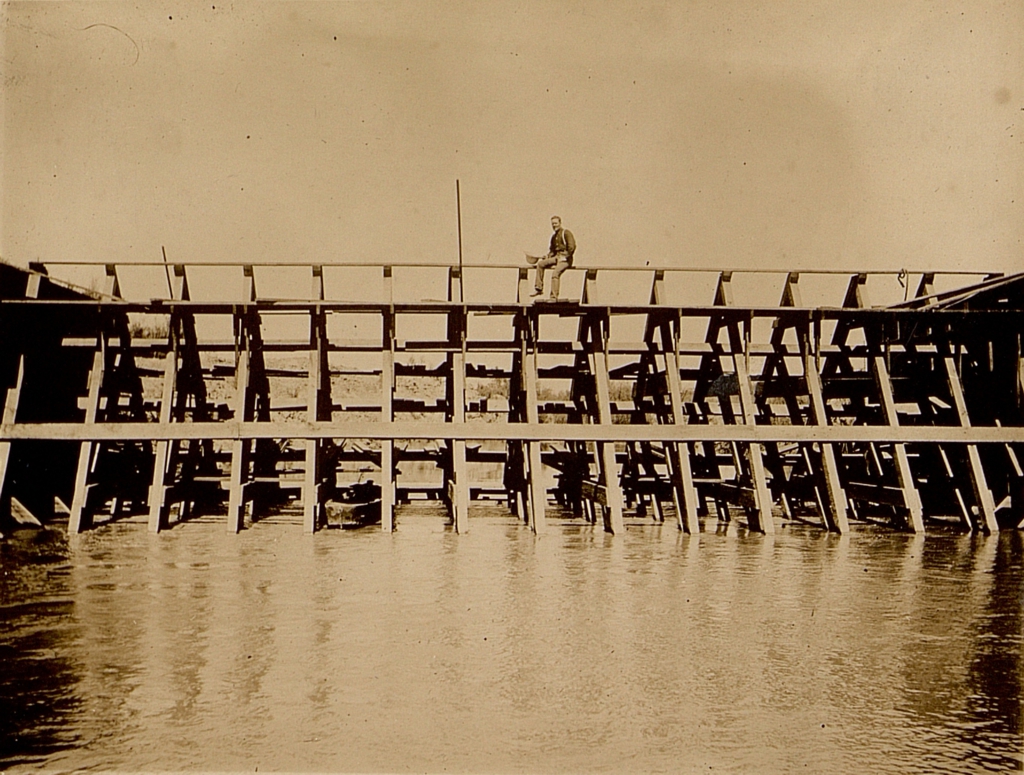
Chaffey Headgate at Pilot Knob, USA
This picture was taken looking north at the rear of the headgate shortly after its completion in 1901
Dec 1900
A dredge named Alpha was used to dig the main channel of the Imperial – Alamo Canal starting from just inside the US side of the Mexican border at Pilot Knob, CA, USA. After crossing the US / Mexico border, it dug south about 4 miles where it connected to the Alamo Arroyo. George Chaffey, the engineer of the canal, failed to consider the high silt level of the Colorado River and did not design or construct the channel in a fashion that would prevent build up of silt.
The problems arising from the deficiencies of the canal were not noticed for several years and would later prove to be the original source of a future disaster.
Dredge Alpha
Notice the dim silhouette of the Algodones Dunes to the north on the left of the picture.
Sources & Additional InformationMay 1901
Water from the canal system first flowed into the Imperial Valley on May 14th, 1901 when the headgate at Sharp’s Heading was opened. Shortly after that the irrigation of farmland began in earnest, but not all of the water delivered to the valley was used.
Excess water was allowed to flow into the Salton Sink marking the birth of the new Salton Sea.
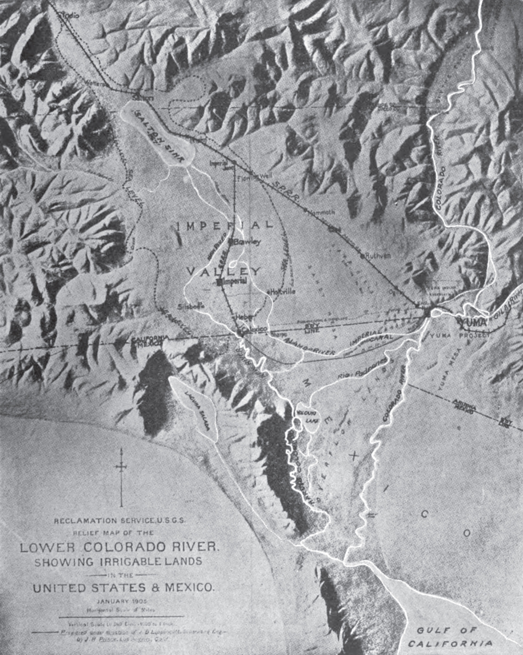
Early Relief Map of the Lower Colorado River Region and Imperial Valley
Notice the area that appears to be the Salton Sea is actually the Salton Sink as this drawing was made half a decade before the floods that created the Salton Sea. The white lines north of the border leading to the Salton Sea are the New River and Alamo River.
Sources & Additional Information1902 – 1903
The Newlands Reclamation Act of 1902 was passed by the US congress, but did little to immediately affect the Imperial Valley as reclamation of the desert land to irrigable farmland was already well under way.
The population of the Imperial Valley quickly grew to over 50,000 people in just a couple of years and irrigable land increased to well over 100,000 acres. Entire towns were built, railroads were extended, and hundreds of miles of additional canals were built to deliver water to individual farms.
With the water flowing and readily available, growth in the region exploded, but there were problems on the horizon.
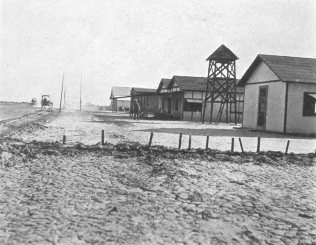
Imperial City, early 1900s
Sources & Additional InformationNext; Flood Timeline
Flood Timeline
Sources & Additional Information